The Integration and Application Network partners with a large and diverse group of organizations on great projects with local to global impacts. Each project is new, unique, and important. Our partnerships are designed improve capacity in environmental assessment, community engagement, and create new scientific insights. Browse our current projects below to get an understanding of what we do and how we do it, or click here to view our past projects.
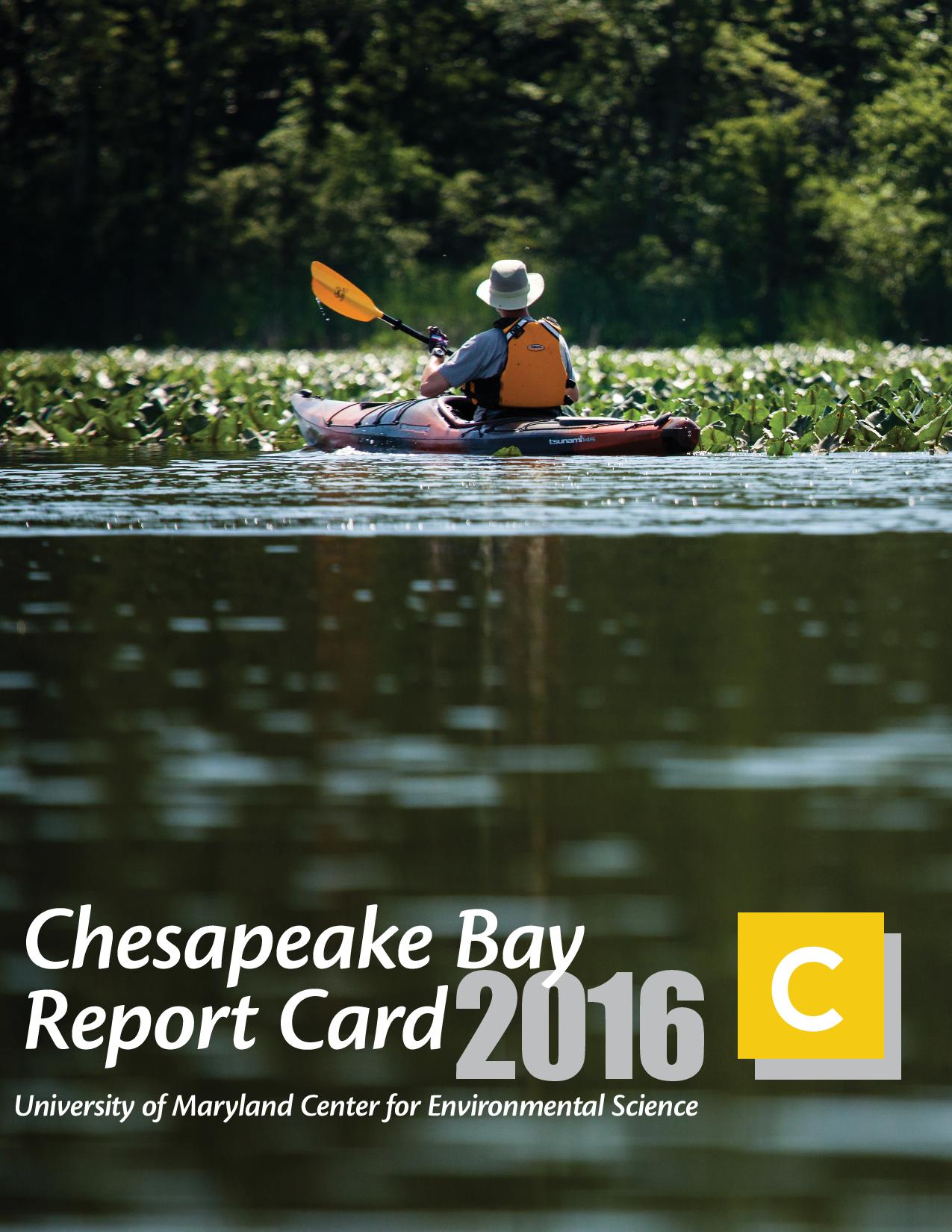
The University of Maryland Center for Environmental Science (UMCES) has a well developed partnership with the Chesapeake Bay Program (CBP). Environmental assessment and science communication of restoration projects is a topic in which the Integration and Application Network (IAN) has been actively involved, including in its partnership with CBP. UMCES scientists are particularly knowledgeable about watershed and estuarine processes and provide technical assistance and training opportunities for CBP activities. In addition, UMCES scientists have experience with innovative approaches in restoration ecology. UMCES uses its Annapolis Synthesis Center for much of the project management, coordination, and administration of the UMCES/CBP partnership.
Healthy Waterways: The story of an amazing journey
Southeast Queensland, Australia is a fast growing region. Rising populations have led to increased stresses on the region's rivers and coastal waters. However, there has historically been a lack of a shared vision on how to reconcile the needs of the region's population with the needs of the region's environment. In order to develop this shared vision, we used broad engagement, equitable partnerships and trusted science. This book documents the amazing journey we embarked on, that reshaped the relationship people had with the rivers and coastal waters of Southeast Queensland.
HPL & NSF Coastal SEES: OysterFutures
The goal of OysterFutures is to develop recommendations for oyster policies and management that meet the needs of industry, citizen, and government stakeholders in the Choptank and Little Choptank Rivers.
IAN: Environmental Science Films on YouTube.com
We strive to inspire future scientists and increase awareness about environmental issues. We believe that new media is a integral part of achieving these goals. Therefore, we have launched an IAN/EcoCheck channel on YouTube. This channel hosts environmental science videos created by UMCES faculty, staff, and students.
IAN: Science Communication Courses
A keystone of the Integration and Application Network is effectively communicating science to a broad audience. This one- to three-day course provides participants with a science communication toolbox for effectively communicating their data. At the close of the course, participants will have learned the principles of effective science communication, used hands-on sessions to create their own products (symbols, conceptual diagrams, presentations, newsletters, posters), and gained experience in relevant software programs. These courses are made up of modules and can be tailored to meet the needs of any interested funding agency.
IAN: Symbol Libraries
This free, downloadable symbol library has been providing users with symbols crafted by IAN science communicators for use in constructing conceptual diagrams. This project involves getting the symbols uploaded individually to our searchable image library, adding many new symbols, and making them all available through our online diagram creator.
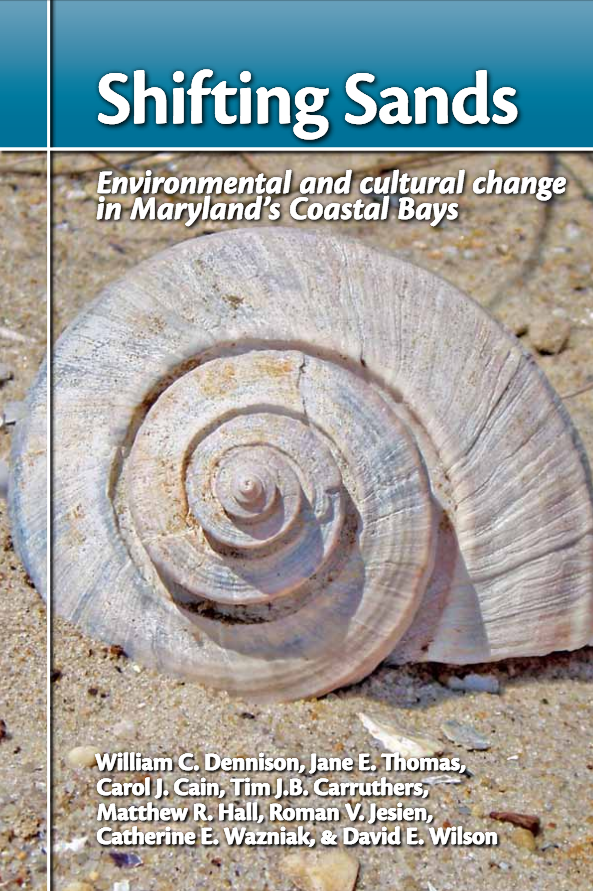
Maryland's Coastal Bays, the shallow lagoons nestled behind Ocean City and Assateague, comprise a complex ecosystem.
These estuarine bays, at the interface between fresh and saltwater, provide habitat for a wide range of aquatic life. But like many coastal systems, they face threats from intense development, nutrients, sediments, and other stresses associated with human activities.
IAN has been working with the Coastal Bays Program on various products and studies, including the annual Coastal Bays report card, the book Shifting Sands, and using stable isotope techniques to identify nitrogen sources in the Maryland Coastal Bays.
National Fish and Wildlife Foundation: Coral Reef Ecosystem Status and Trends Report Cards
The National Oceanic and Atmospheric Administration Coral Reef Conservation Program (NOAA-CRCP) is investing significant funding to support a National Coral Reef Monitoring Plan (NCRMP) throughout the U.S. Pacific, Atlantic, and Caribbean coral reef areas. The Integration and Application Network at the University of Maryland Center for Environmental Science (IAN-UMCES) understands that a key component of this plan is periodic national-level status and trends reporting. Such reporting will be required to communicate and evaluate the efficacy of place-based investments in coral reef conservation, and the aligned goals and objectives of the NCRMP (as per the NOAA-CRCP NCRMP, 2014). This grant will fund IAN-UMCES to collaboratively develop and implement this status and trends reporting framework with NOAA-CRCP for two pilot areas, American Samoa and the Florida Keys that will be used to develop and pilot the new reporting framework based on biological, physical and socio-economic monitoring data. Report cards for the remaining Pacific jurisdictions will be undertaken during 2017-2018.
NOAA: Beach water quality prediction mobile app development
In partnership with the University of South Carolina and SECOORA, we first developed a mobile app that displays predictions of water quality at 31 locations along the beach at Myrtle Beach, SC. Daily predictions are created using statistical models that incorporate data from remote sensing and ocean observing system sensors. The tools for developing these statistical models have been improved by merging our efforts with the EPA's Virtual Beach model development software, which was intended to automate the laborious process of statistical model generation for non-statisticians. These tools have been implemented in Sarasota FL and are being modified for recreational and shellfish harvest area water quality in Charleston Harbor, SC.
NPS NCR Resource Stewardship Strategy Tool
NPS: HATU Natural Resource Condition Assessment
The National Park Service is carrying out assessments of the natural resource condition (NRCA) for nearly 300 of the National Parks throughout the country deemed to have significant natural resources. This project, to assess condition of Harriet Tubman Underground Railroad National Historic Park in Maryland, is a synthesis project aimed at collating and synthesizing all available data to assess current status and trend for each metric, combining these into an overall framework.
Sudbury, Assabet, Concord Rivers Report Card Workshop and Staff Training
OARS, a watershed organization working on the Assabet, Sudbury, and Concord Rivers in Massachusetts, has been interested in preparing a report card summarizing the health of the three rivers for some time. The Sudbury-Assabet-Concord (SuAsCo) is a small watershed in eastern Massachusetts, with both developed and natural areas. UMCES will facilitate an initial project workshop to work through elements of the 5-step report card process. UMCES will also facilitate a training of key OARS staff in producing the report card after the stakeholder workshop. UMCES will continue to advise and support OARS throughout the report card process by attending intermittent video calls and by reviewing the report card. The training will enable OARS to replicate the 5-step report card development process in other watersheds throughout Massachusetts where there are local groups interested.
U.S. Army Corps of Engineers: Evaluation of Multi-Year Data Sets to Establish Status and Trends of Environmental Restoration Success in the Everglades
The purpose of this project is to evaluate recent scientific findings that demonstrate progress towards restoration goals for the Everglades, identify research gaps related to the function of the Everglades ecosystem, and to make recommendations for management decisions based on those findings. This system status assessment will be used to convey these findings for the system as a whole and regions of the Everglades to public resource managers and stakeholders. Findings from this assessment will be evaluated for inclusion in the 2017 System Status Report and the 2020 Comprehensive Everglades Restoration Plan Report to Congress.
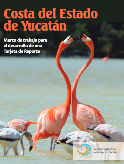
UNAM State of Yucatan Report Card
The Yucatan coast of NE Mexico that borders the Gulf of Mexico supports a high biodiversity of plants and animals, as well as important fisheries and tourism activities. However, the region's rapid growth in terms of coastal development is putting immense pressure on these natural resources. IAN staff, Dr. Heath Kelsey and Jane Hawkey will develop an ecosystem health report card with Dr. Paulo Salles Afonso de Almeida and Irina Ana Rosa Ize Lema, both of the Universidad Nacional Autonoma de Mexico (UNAM). A report card workshop was held at the National Coastal Resilience Laboratory (LANRESC) in Sisal, Mexico, assembling stakeholders and scientists interested in ensuring the sustainability of these coastal resources, and to begin the process of creating an ecosystem health report card.
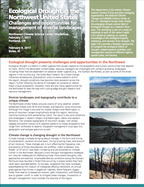
USGS: Climate Change Research Activities Synthesis
The Department of the Interior Climate Science Centers (CSCs), and their managing organization, the National Climate Change and Wildlife Science Center at the U.S. Geological Survey, have chosen the emerging climate science field of Ecological Drought as a research focus area. This project aims to conduct synthesis and dissemination of the state of knowledge, research activities, and information gaps that exist within the eight Climate Science Centers (CSC). The Integration and Application Network (IAN) has developed a three-year Science Delivery Strategy to achieve this goal, aimed at supporting the first goal: to assess and synthesize our state of knowledge about climate change impacts to DOI lands. The eight CSCs provide a fantastic opportunity to compare the ecological effects of drought, related research activities, and management options at different regions, spatial scales, and biomes.
WWF-UMCES Partnership
WWF and the University of Maryland Center for Environmental Sciences seek to empower stakeholders around the world to develop and effectively use credible, locally owned report cards in their basins, fostering sustainable water management across basins around the world. We are developing, packaging, and sharing a process that helps stakeholders create science-based report cards in their own basins with the right buy-in on-the-ground and credibility globally, so they can better manage resources for the protection of fresh water they depend upon.
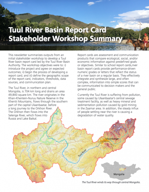
WWF-UMCES Partnership: Tuul River Basin Report Card Development
UMCES and WWF have partnered to facilitate the development of Report Cards in many iconic and threatened river basins across the world. UMCES, WWF, and the Tuul River Basin Authority are collaborating on the development of a river basin report card in the heart of Mongolia. UMCES is participating in a series of workshops as trainers, assisting WWF-Mongolia in the development of the report card, including troubleshooting and providing guidance as the Report Card progresses.