Background
Global climate change is resulting in sea level rise in many coastal systems worldwide. Parks in the National Capital Region (NCR) of the National Park Service (NPS), including George Washington Memorial Parkway, the Chesapeake and Ohio Canal National Historical Park, National Capital Parks – East, Rock Creek Park, and the National Mall and Memorial Parks, manage land along the tidal freshwater sections of the Anacostia and Potomac Rivers. The impact of sea level rise in these parks is arguably the most pressing problem related to climate change.
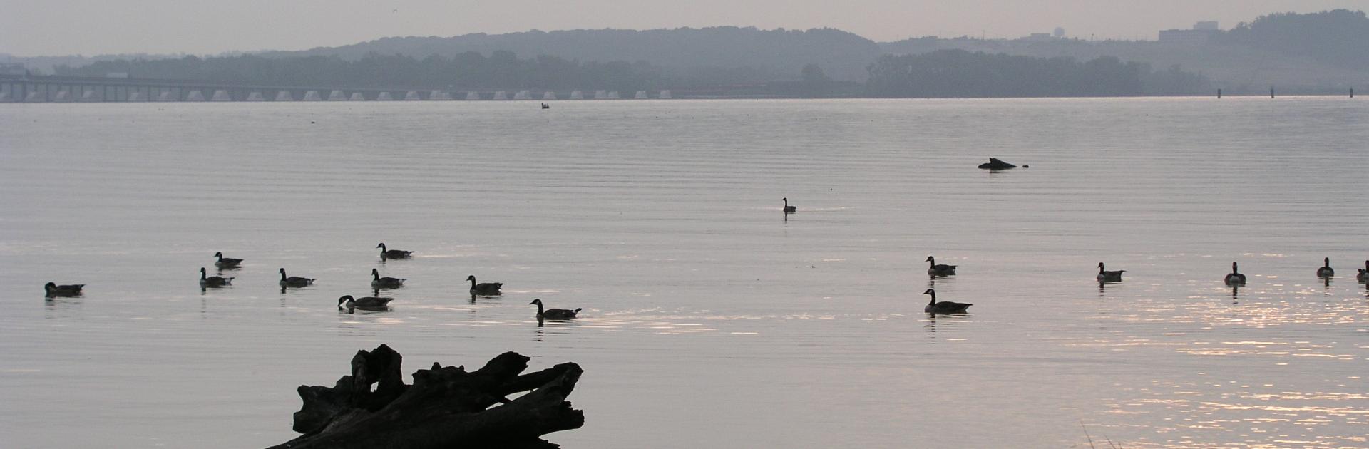
Low-lying coastal areas in the NCR parks contain a diversity of natural, cultural, and historical resources as well as important transportation resources. The relative rate of sea level rise for the Washington, DC region is roughly 3.5 mm/yr. Rising sea level could result in more frequent inundation, possible displacement of resources,and higher risk of storm damage. These risks are compounded by trends in coastline development, which limits flexibility and increases the cost of the most practical management solutions. It is incumbent upon the NPS to identify the possible risks to resources and develop strategies to adapt to potential changes. It is also important for the NPS to look at current and future restoration or capital improvement plans to determine if they account for the potential impacts resulting from sea level rise.
This project focuses on tidal freshwater marshes and coastal forests to evaluate the vulnerability of NPS biological resources (habitat, species diversity, and risk of invasive species) to sea level rise, and to provide park managers with information and tools to improve their ability to make informed management decisions. Even though examining the impact to cultural resources is not a focus of this project, the tools, data, and results could be leveraged to determine areas of risk.
Methods
The project integrates two primary models to first predict the impact of sea level rise on the spatial distribution and area of critical coastal habitats, and second, to model the proportion of species expected to be lost due to habitat area changes. Important components of the modeling framework include:
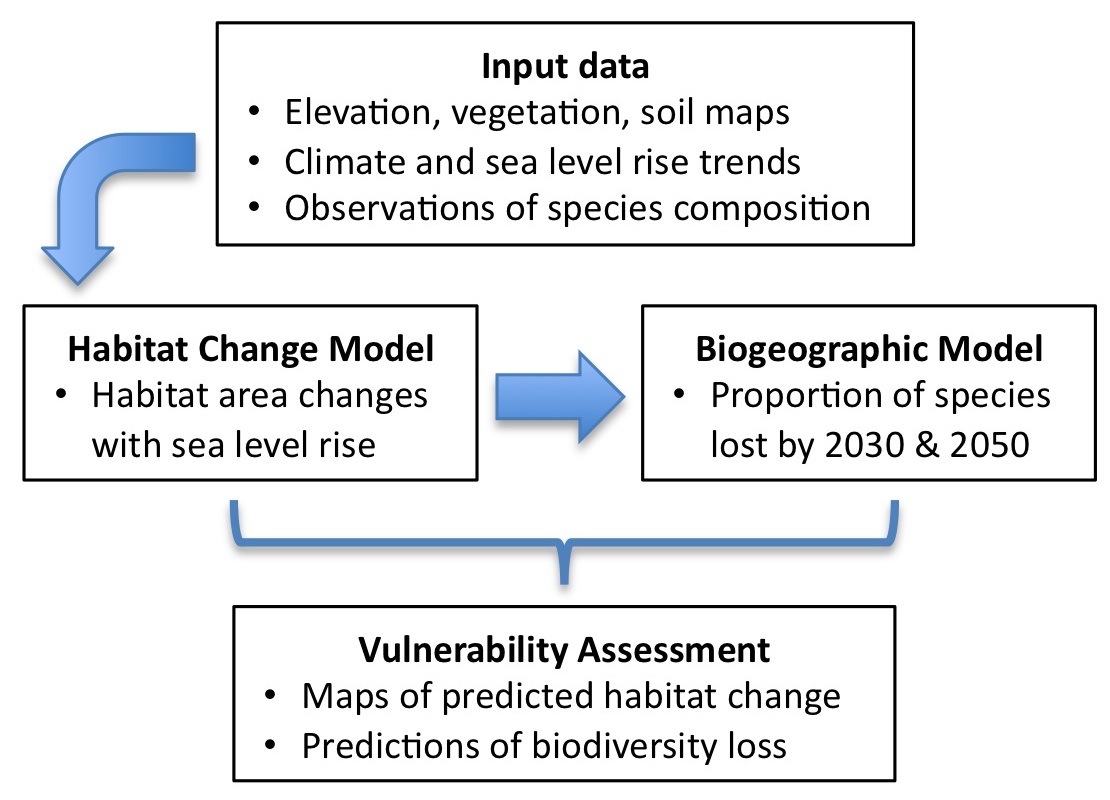
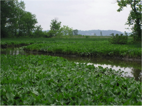
- Required data include high-resolution digital elevation models (DEMs) derived from Light Detection and Ranging (LiDAR) surveys and high-accuracy thematic maps of habitat. Of particular interest are the highly diverse freshwater marshes, which are distributed along many coastal sections in the NCR; the project includes developing a digital classification of these critical habitats.
- The project will use the Sea Level Affecting Marshes Model (SLAMM) to forecast the impact of a suite of sea level rise scenarioson marsh and coastal forest habitat area. SLAMM integrates simple inundation concepts with more refined representations of accretion and coastal erosion. Because the project will use high-resolution input data (1m/pixel) the resulting habitat change maps will reveal fine detail in the predicted changes.
- In the second modeling stage, a new type of biogeographic model called Generalized Dissimilarity Modeling will use hundreds of plot-based observations of plant species composition to characterize the biodiversity of modeled plant communities across the study area. The proportional change in habitat area of each plant community will then be related to the proportional loss in species richness.
- In a third, and final project component (not included in Figure 1), climate envelope modeling will be used to estimate source regions of potential invading species to the tidal freshwater portion of the study area.
All modeling components will be conducted using climate and sea level rise scenarios for management-relevant periods (e.g. 2020 – 2050). Wherever possible, vegetation and elevation data sets will extend outside of the parks to aid future land acquisition decisions that might be appropriate for maintaining park biodiversity.
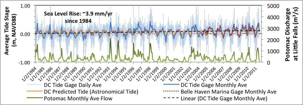
Two tide gauges in the study region provide a record of recent sea level rise. Observed tides have been increasing relative to predicted tides (based on astronomical data) at a rate of 3.9 mm yr-1since 1984. Seasonal flooding due to spring melt and the autumn hurricane season result in high waters that exceed the predicted tide by as much as 1.00m. These conditions have historically caused significant flooding in the NCR parks:
Products
Proposed final products are intended to provide valuable information to park managers planning for expected sea level rise. Park interpreters and educators will be provided with tools to educate park visitors and broader audiences. The final project report and interpretive materials will include:
- Enhanced vegetation maps that integrate the strengths of existing maps
- Maps of habitat change associated with a suite ofsea level rise scenarios. These will be generated in a common Geographic Information System (GIS) format as well as digital image format for inclusion in interpretive materials.
- Maps and statistical summaries of expected biodiversity changes for the modeled plant communities.
- Interpretive products including park seminars and visualizations tools will be generated and disseminated at the NCR parks.
- A comprehensive report detailing the data and methods used to generate the final products.
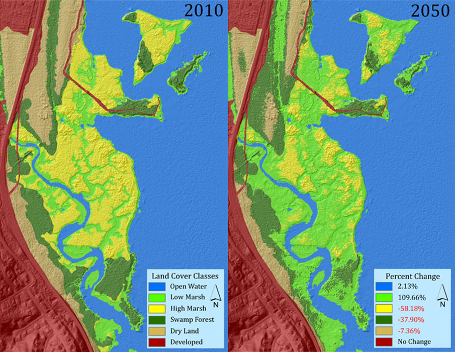
Illustrated below is SLAMM projected habitat change for the Dyke Marsh Preserve from 2010 to 2050 based on the Intergovernmental Panel on Climate Change (IPCC) scenario A1B mean scaled to 1 meter sea level rise in 2100, which predicts a SLR of 0.31 m by 2050. This scenario represents an accelerated rate of sea level rise and is at the upper end of the range of modeled scenarios. As a result, SLAMM output exhibits significant habitat area changes (shown in the 2050 legend), which range from over 100% increase for low marsh to a decrease of 58% for high marsh.
This project was funded by the NPS through a cooperative agreement with the University of Maryland Center for Environmental Science, Appalachian Laboratory.