Advisor: Greg Silsbe, Horn Point Laboratory
The following interview was conducted remotely. Currently, field and laboratory research is restricted due to COVID-19 precautions.
What is the focus of your research?
My research focuses on satellite and drone remote sensing in the coastal waters of Chesapeake Bay to help better understand water quality. I am interested in improving the accuracy of remotely sensed products in optically complex waters as they are influenced by confounding optical properties such as dissolved organic matter, phytoplankton, and suspended sediments.
How will it make a difference?
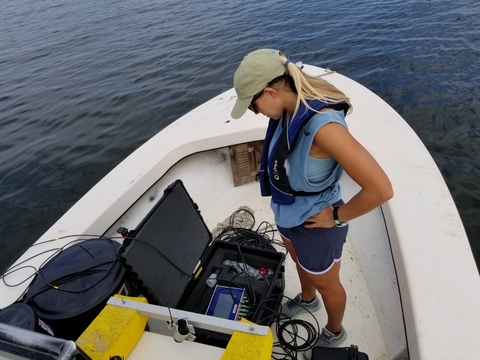
Traditional water-monitoring programs often lack the monitoring frequency and spatial resolution needed to capture changes in water quality. By integrating remote sensing imagery with high spectral, spatial, and temporal resolution, scientists and managers can monitor critical marine and coastal ecosystems more consistently and accurately. Collecting data from satellites can help fill in key gaps in observations collected intermittently by boat. By examining imagery collected from multispectral sensors on satellites, we can quantify the reflectance, or colors, from the water surface. Then, by using numerical algorithms, we can translate that reflectance into estimates of scientifically valued parameters such as chlorophyll-a concentration and suspended sediment concentrations.
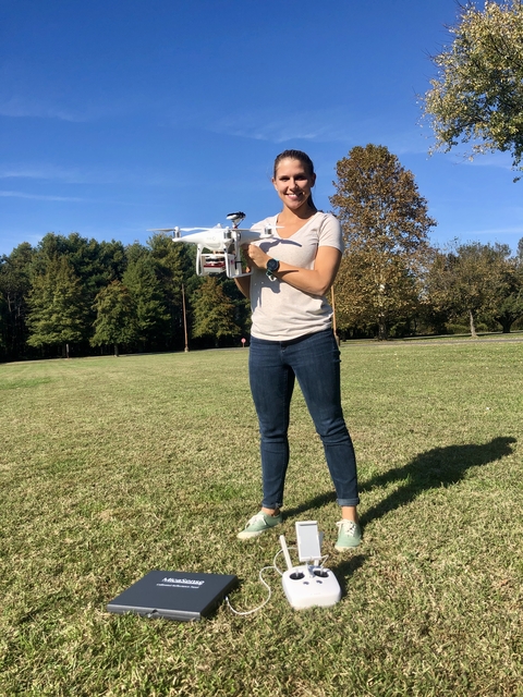
With this research, we can derive water quality conditions for the entire Bay each time a satellite passes over. Similarly, drones derive water quality conditions in the same way, but can do so at a much higher resolution since they fly at a much lower altitude. Later on in my research, I will use a hyperspectral camera, which can detect many more colors within the visible spectrum, on a drone in order to discriminate different phytoplankton taxa in Chesapeake Bay waters. This research will provide unprecedented spectral information to significantly advance coastal water quality monitoring and harmful algal bloom identification.
What influenced your career path in science?
I always say that sea turtles were my gateway into marine science. During my undergraduate career, I was given the opportunity to do a summer internship on sea turtle nesting activity in southwest Florida. During that summer, I was inspired to continue similar research and started looking at graduate programs. I chose to attend the Nicholas School of the Environment at Duke University, where I became exposed to drone technology for marine science applications. My master’s research consisted of using an autonomous robotic to measure nighttime light pollution at a sea turtle’s eye level. I also conducted some research using aerial drones to study exposed intertidal oyster reefs. Becoming immersed in this new remote sensing technology, I felt compelled to apply to Ph.D. programs, specifically in Maryland where I am from, to learn more about how remote sensing can be used to study water quality. Now I am studying how satellites can collect pertinent information on bio-optical properties such as chlorophyll and suspended sediment.
Why did you choose to study with your mentor at UMCES?
I wanted to find a Ph.D .program in Maryland in order to study and help protect the waters that I grew up fishing, swimming, and recreating in. I knew of Horn Point Laboratory from connections at my nearby undergraduate college, Washington College. I was encouraged by an undergraduate professor to look up the work of Greg Silsbe since he had remote sensing expertise. After talking and meeting with him, I knew I would get a more comprehensive understanding of remote sensing and benefit from his expertise in linking remote sensing products to phytoplankton productivity.
What is an experience that stands out most to you about your time at UMCES?
An experience that was rewarding during my time at UMCES was getting the opportunity to run drone mapping workshops for K-12 students. Working with the environmental nonprofit ShoreRivers, we hosted 85 Dorchester County high school students to explore remote sensing technology. Students were provided a hands-on experience with drone technology and programming and learned about the different research scientists are conducting using this new technology. It was very rewarding to see hesitant students become more confident and interested in science throughout the duration of the workshops.
What is the most important thing people can do to help the environment?
There are a lot of ways people can help the environment. They can decrease their plastic usage, choose to walk or bike instead of drive, eat a vegetarian diet, use hybrid or electric cars, and much more. I think the most important thing people can do to directly help the environment is to get politically active. The most effective solutions to climate change require governmental action, so letting your representatives know you want them to take action can help get those decisions made.
Do you have advice for kids in the next generation who are interested in STEM fields?
Make it known that you are interested in STEM. If you express to your teachers, professors, and colleagues that you are interested in a particular STEM field, they can often help or connect you with someone who can help. Educators want to support students, so it is likely that if you seek out information or resources from these types of people, they will provide some very useful information such as professional contacts, internship opportunities, jobs, and more.
Have you received a scholarship, grant, travel award or gift from a donor? What did it allow you to do and why was that important?
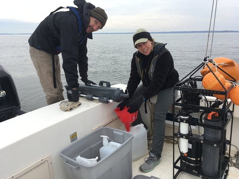
In 2019, I received the Ryan Saba Memorial Student Fellowship which was established at Horn Point Laboratory by his friends and family to honor and remember Ryan Saba who was a research assistant at HPL. With this award, I was able to attend an intensive two-week satellite remote sensing training program at Cornell University. At this course, I learned the necessary skills to acquire, analyze, and visualize satellite remote sensing datasets, which has been extremely useful in my Ph.D. research. In 2020, I was also awarded a scholarship from the Mid-Shore Chapter of the Izaak Walton League of America. This award will provide funds to conduct fieldwork that is necessary to validate the measurements satellites collect.
When do you anticipate earning your degree?
I plan on graduating with my Ph.D. degree in 2023.
What are your future plans?
Upon graduation, I would like to continue related remote sensing of coastal waters research at the Earth Sciences Division at NASA’s Goddard Space Flight Center. I believe I would benefit from working at a government agency and could gain valuable knowledge from collaborating with other remote sensing scientists. However, my long-term goal is to teach at a university or college. I’ve always had a passion for teaching and see myself working in a faculty position at a school that emphasizes teaching, so that I can mentor diverse students and help them become advocates for their environment.


