Dolphin sightings in the Bay
Home Bay sightings Our research Our team Donate (opens in a new tab) Supporters Photos & videos Resources FAQs Get involved
DolphinWatch is still growing
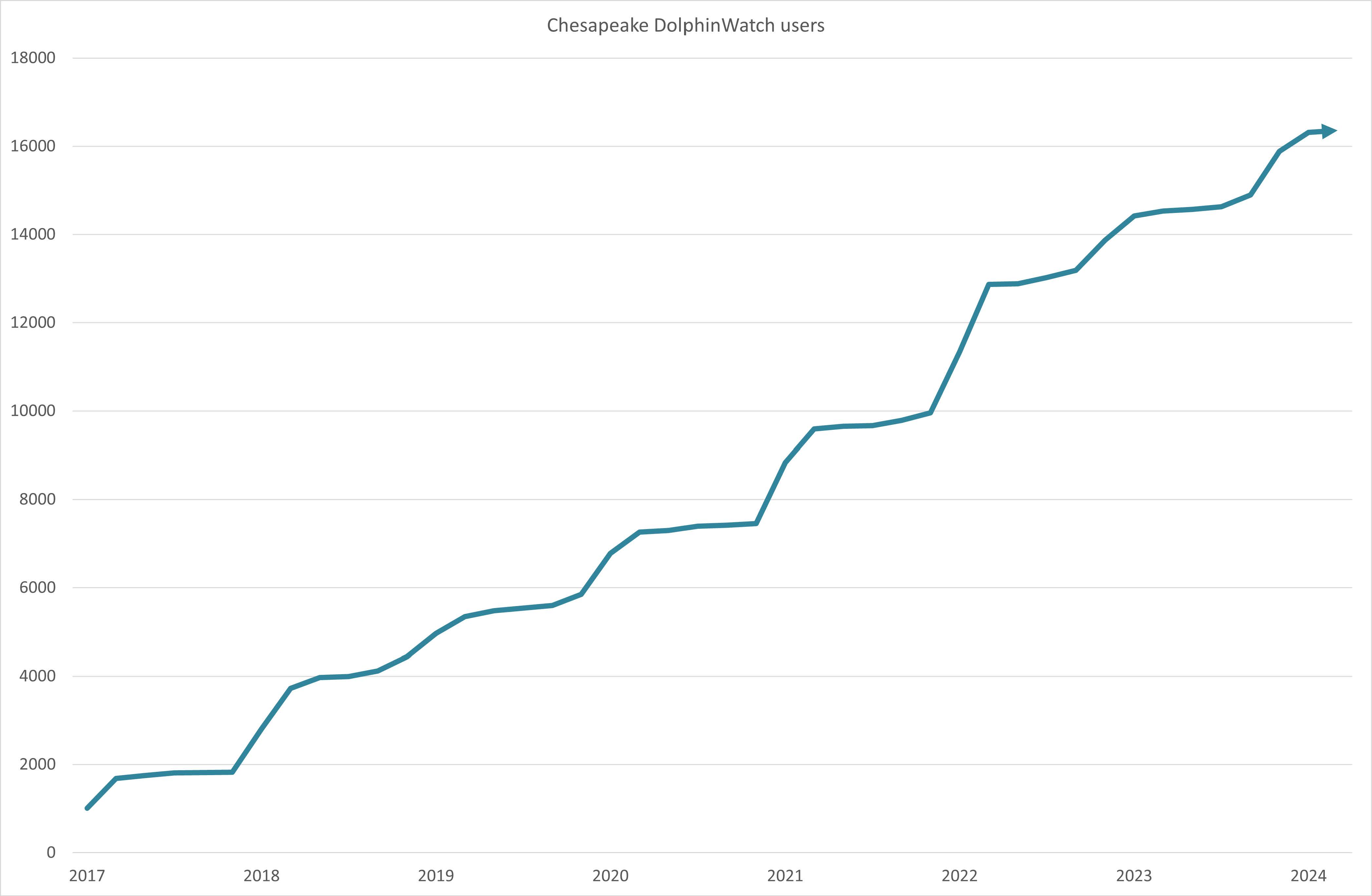
Since launching the app in 2017, we’ve seen a steady increase in registered users. This graph depicts the growth in registered users of the Chesapeake DolphinWatch app from 2017 to 2024. The consistent upward trend signifies increasing public interest in dolphin conservation and citizen science. As numbers increase, our capacity to gather important data on bottlenose dolphin populations in the Chesapeake Bay builds.
Join us! All you need to provide is your name and email address to setup an account. We use the email address to contact you about your sightings and occasionally provide important information about changes to the app. We do not share your information.
Every sighting counts
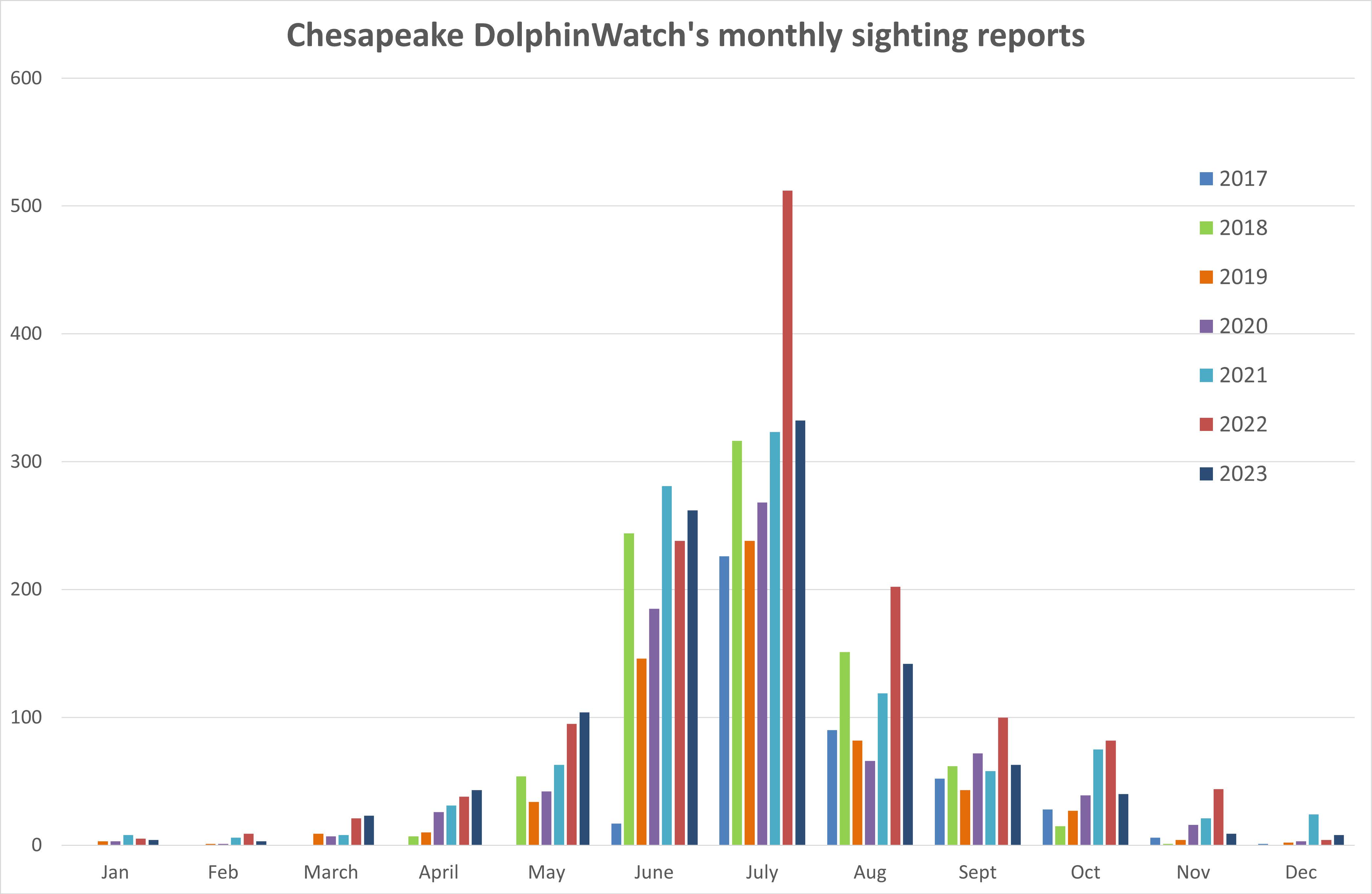
This graph illustrates the monthly dolphin sighting reports from 2017 to 2023, highlighting seasonal trends in the Chesapeake Bay. Notably, July exhibits the highest frequency of sightings. This highlights the importance of ongoing monitoring efforts by Chesapeake DolphinWatch to better understand and conserve the bottlenose dolphin population.
Verified Dolphin Sightings 2024
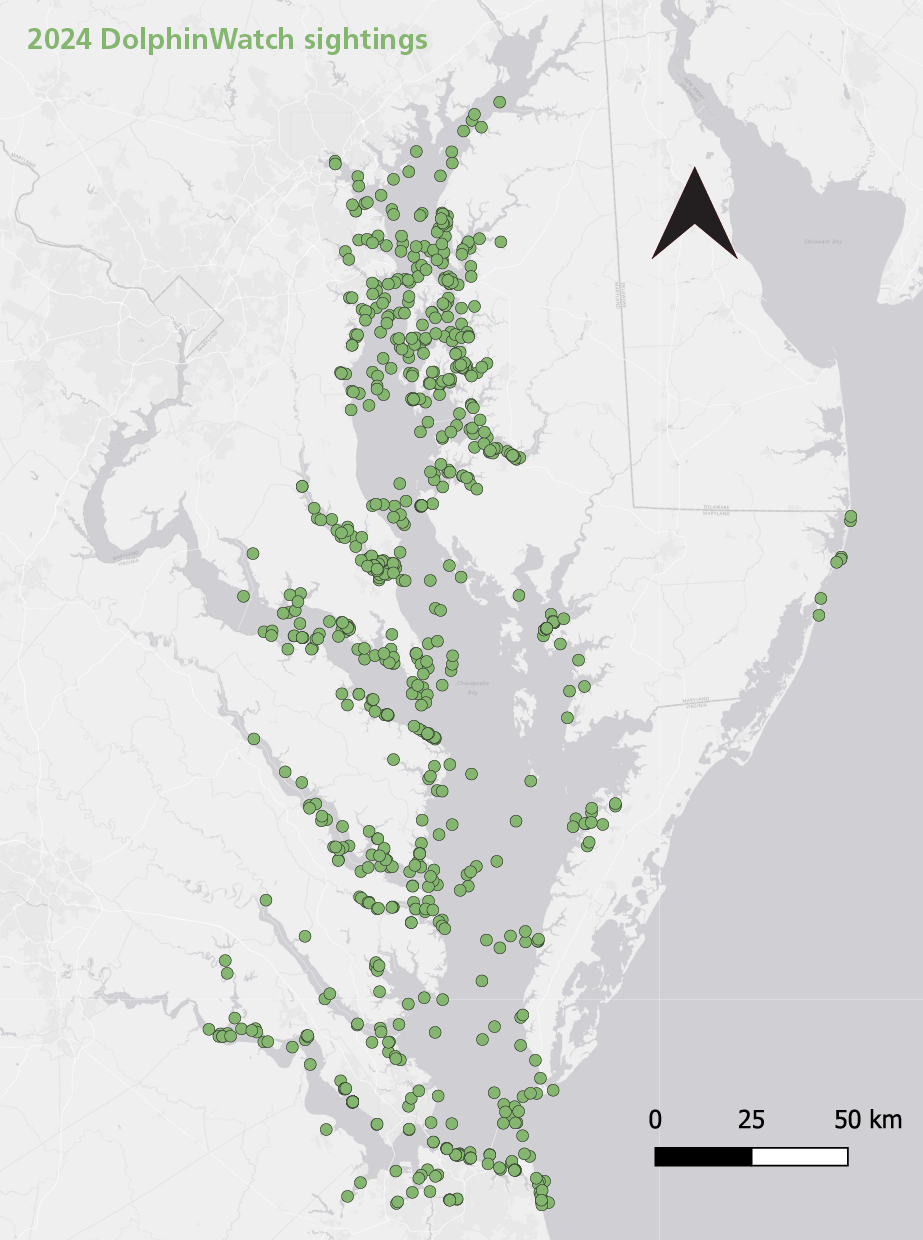
This map displays the verified bottlenose dolphin sightings reported to Chesapeake DolphinWatch in 2024. The abundance of green dots indicate active areas where bottlenose dolphins have been observed, highlighting the distribution throughout the region. These data are essential for understanding dolphin habitat use throughout the Bay.
We found dolphins in most of Chesapeake Bay
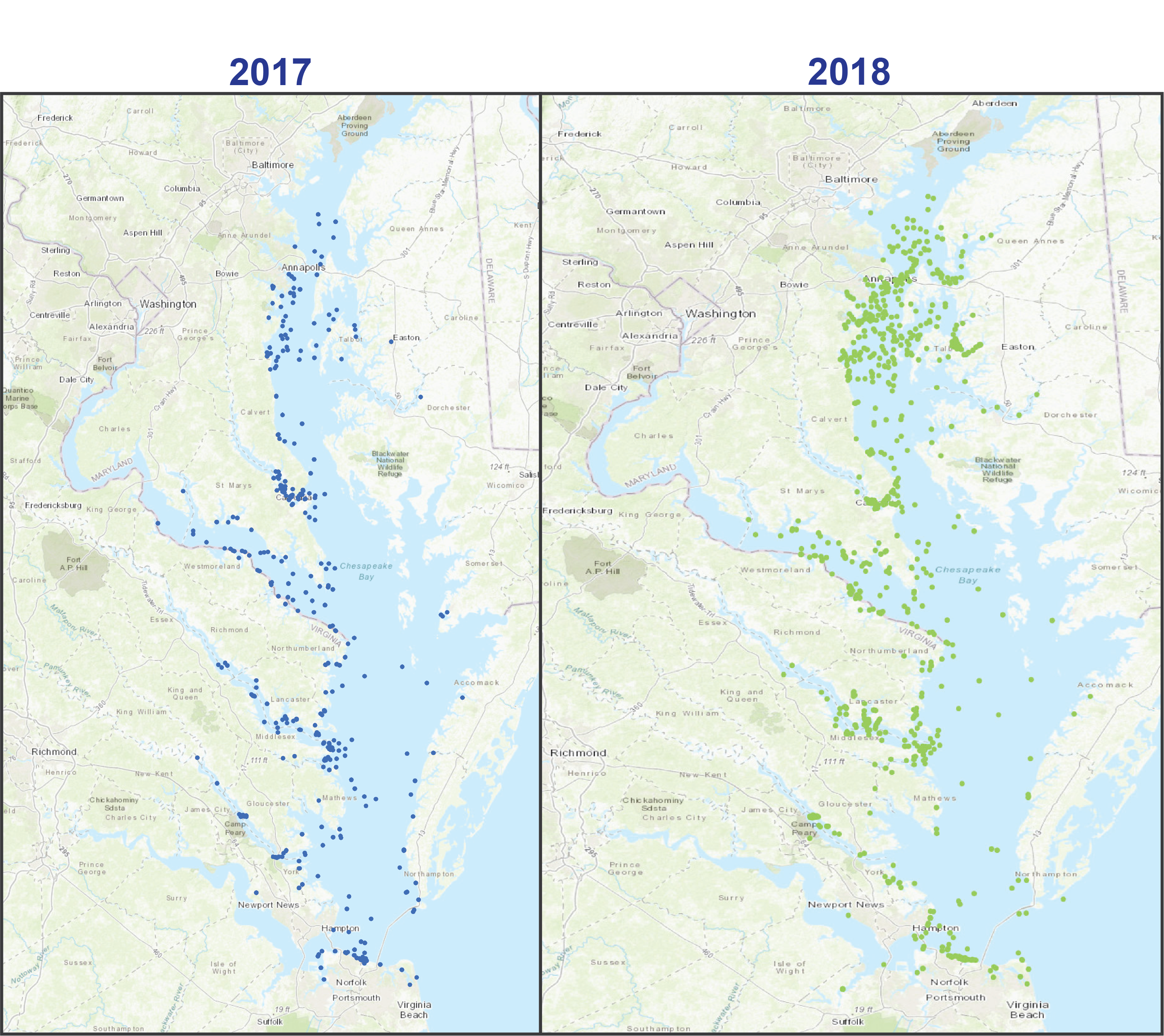
Over the past 8 years dolphin sightings were seasonally stratified in Chesapeake Bay, meaning that dolphins were seen in different portions of the bay in different months.
Dolphins are reported in the Lower Bay nearly year-round. We refer to Lower Bay as the portion of Chesapeake Bay from the mouth at the Atlantic Ocean northward to the Maryland-Virginia state line, including the Rappahannock, Piankatank, York, Poquoson, James, Nansemond, Elizabeth, and Lynnhaven rivers.
Middle Bay sightings are typical in the warm months from April to October. We refer to Middle Bay as the portion of Chesapeake Bay from the Maryland-Virginia state line northwards to the Chesapeake Bay Bridge (near Annapolis. Middle Bay includes Patuxent, Potomac, Choptank, and Wye rivers), as well as Eastern Bay.
Upper Bay sightings are centralized in June and July. The Upper Bay is the portion of Chesapeake Bay north of the Bay Bridge (near Annapolis) including the Chester and Patapsco Rivers.
Seasonal Pattern of Dolphin Sightings
In this video, you get a sense of the seasonal pattern of dolphin sightings. As the waters warm dolphins move into the Bay and northwards. By August of each year dolphins head south and back towards the Lower Bay and Atlantic Ocean. Each dot is a verified dolphin sighting. The colors of the dots change each month.
The video begins with orange dots showing sightings in June 2017. As the map changes to display a new month of sightings, the colors of dots change. The map will display verified sightings by month over 6 years so each year on the map takes about 11 seconds on the video. You can see the years list on the bottom of the screen.
Video created by Lauren Rodriguez.
Want to learn more?
Dive into a recording of Chesapeake DolphinWatch founder Helen Bailey’s presentation at NOAA Headquarters in Silver Spring, Maryland, part of the OneNOAA Science Seminar series. The recording includes presentation slides, closed captioning, and Q&A from the audience.
Watch a presentation by DolphinWatch Coordinator Jamie Testa as part of Chesapeake Biological Laboratory’s Science for Communities series, and listen as she discusses the 5 years of the project.