Coastline management has major impact on rising seas – and tides – in Chesapeake Bay
Global warming and sea-level rise are exacerbating coastal flooding, especially during high tides, but Professor Ming Li of the University of Maryland Center for Environmental Science says how we decide to protect our coasts against rising seas can make the difference between devastation and resilience.


Global warming and sea-level rise are exacerbating coastal flooding, especially during high tides, but Professor Ming Li of the University of Maryland Center for Environmental Science says how we decide to protect our coasts against rising seas can make the difference between devastation and resilience.
“People think tides are driven by the moon and it never changes, but we found that when you raise the mean sea level, it’s also going to change the tides,” said Professor Ming Li of UMCES’ Horn Point Laboratory. “Coastline management has huge implications in how the coastal locations react to changes in tides.”
Sea levels that rose a foot or less during the past 100 years could rise by 6 feet or more in this century—2 or 3 feet in the next 30 to 40 years. Long and convoluted coastlines along Chesapeake and Delaware bays present significant challenges for developing effective strategies to mitigate coastal flooding risks.
— Ming Li
Professor, Horn Point Laboratory
What you do with coastline management has huge implications in terms of how the tides in Chesapeake Bay respond to sea level rise.
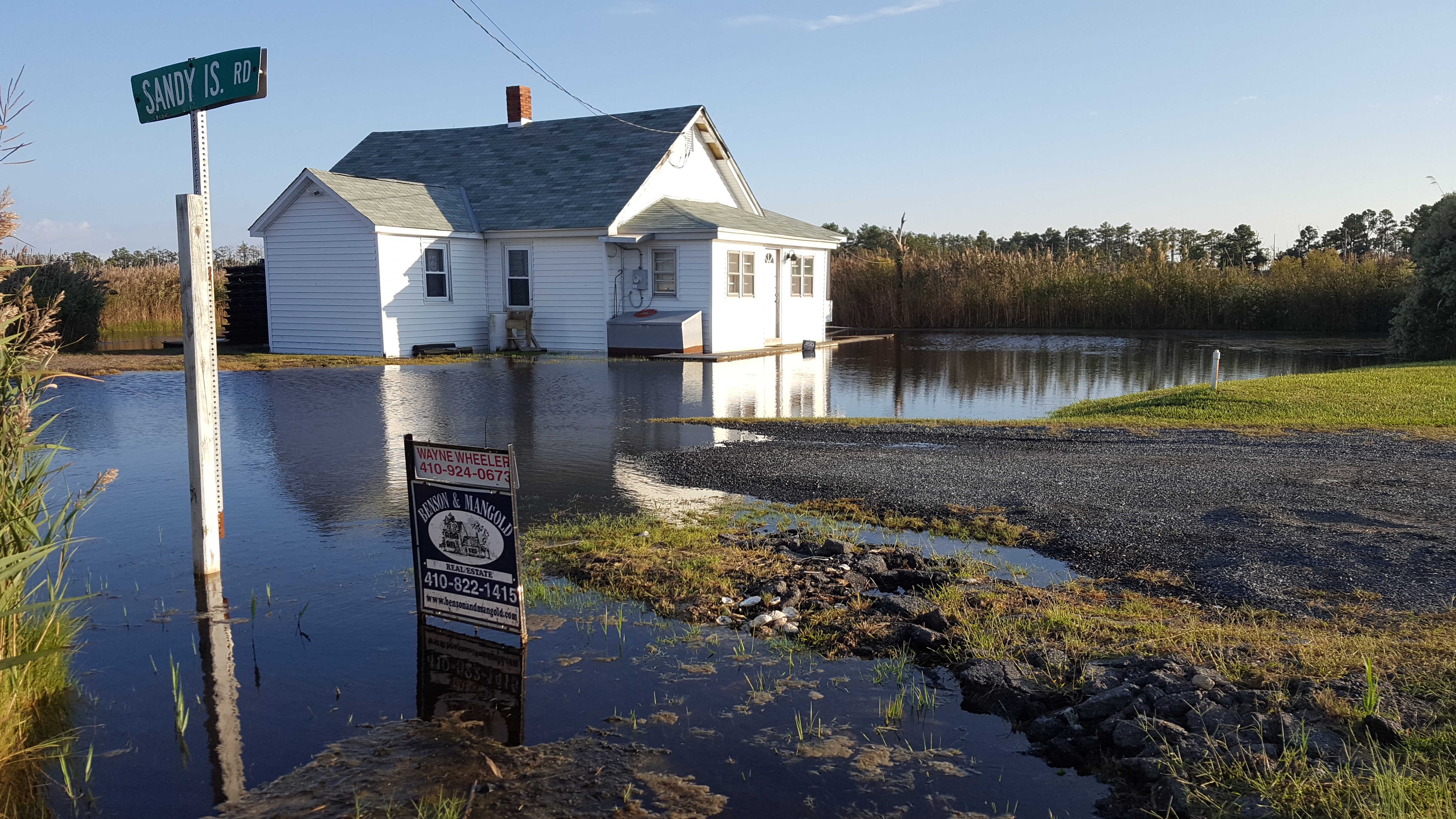
Coastal inundation, or flooding, occurs when sea levels are higher than the normal extent of the tide. Estimates of future flooding events due to sea-level rise have been made by simply adding the expected sea-level rise to present-day tides. However, tides themselves are affected by changes in water depth, so sea-level rise will change the position of high or low tide. Recurrent flooding due to high tides is already a problem for low-lying areas on the Eastern Shore.
“Climate change is real; sea-level rise is happening,” said Li. “We have to understand it and plan for it right now.”
Ming Li and his team developed a numerical model to investigate the effects of sea-level rise on the tidal range in Chesapeake Bay and Delaware Bay. The study calculated what would happen if seawalls were erected along the coastlines of Chesapeake and Delaware Bays to protect low-lying areas from flooding versus allowing the waters to take over the land. They found that hard shorelines, such as seawalls and levees, significantly exacerbate the height of the high tide, while more natural landscapes, such as marshland, minimized the tide height.
The researchers found that seawalls actually increased the tidal range, making high tide even higher than it would be without the wall. When vertical walls are added to coastline, the characteristics of tidal wave change due to the larger water depth. Allowing the water to flood existing land dissipated the water into new areas.
“Instead of going upstream, it’s going sideways,” says Li of tides against a natural shoreline. “The tidal wave energy is being dispersed.”
How governments respond to coastline management to defend communities from rising seas will have major implications. Li’s study shows different strategies have different consequences.
“What you do with coastline management has huge implications in terms of how the tides in Chesapeake Bay respond to sea-level rise,” said Li. “Allow them to flood low-lying areas, then the tidal range in the upper reaches of the estuary will decrease about 15%. If you try to build hard shorelines you’re going to amplify by 15%.”
For example, in big cities in the region, when high tide hit during peak sea level, the difference in flood waters between the hard and soft shorelines would be 18% in Baltimore, 11% in Washington, D.C., and 21% in Philadelphia.
“If we have a storm like Isabelle in 2100, when the sea level is higher, and have hard shore everywhere, the surge height will increase 4 feet, in addition to the 3-feet increase in the mean sea level due to sea-level rise” he said. “This is a very significant problem that has practical implications for those lying in low areas. It’s important for local people to pay attention and figure out how can we help each other.”