Deep dive on remote sensing leads to prestigious award for young scientist
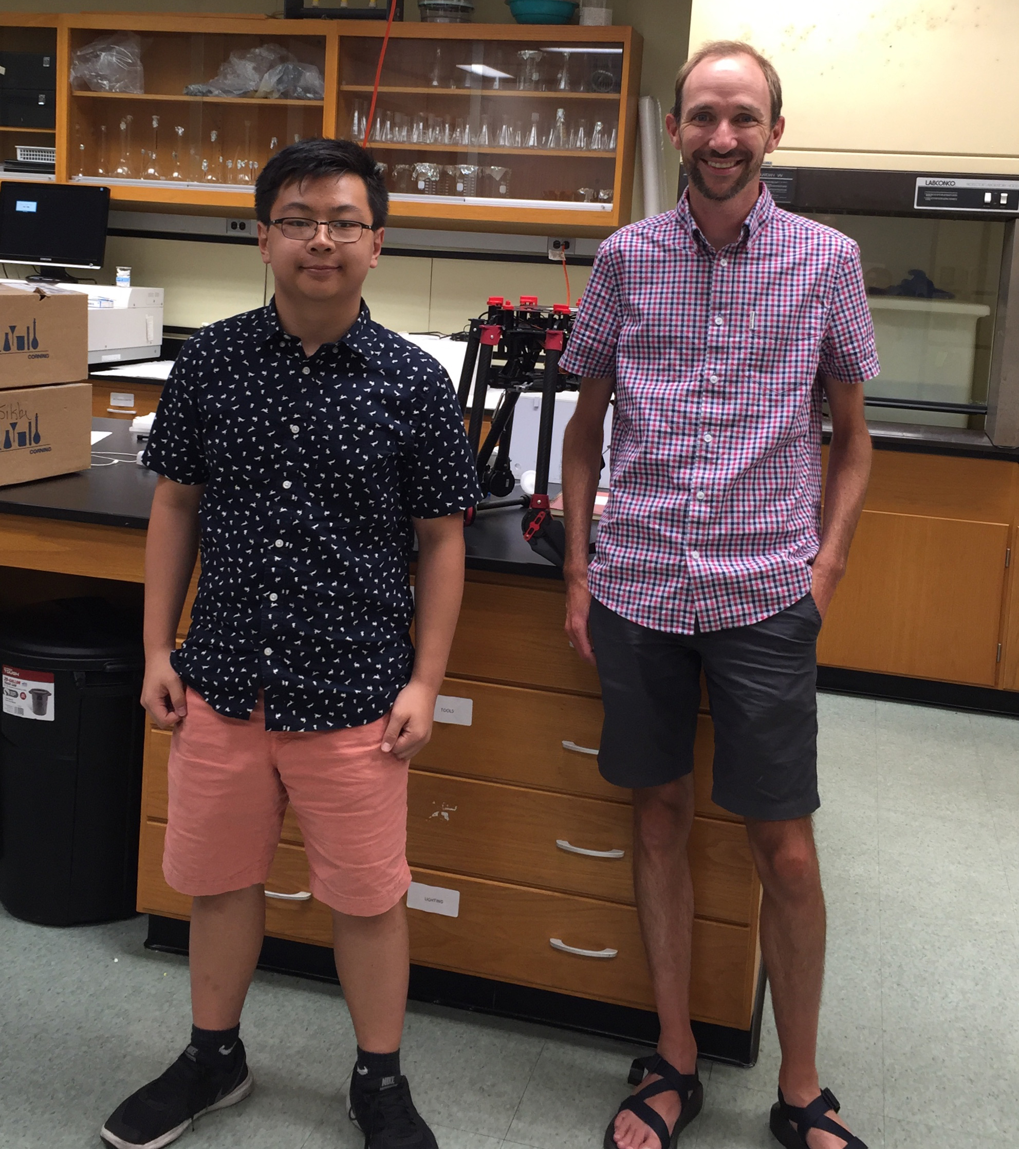
Using the Chesapeake Bay as a study site, student Marvin Li worked with Horn Point Laboratory faculty member Greg Silsbe to use advanced machine learning tools to develop a new algorithm for satellite remote sensing of coastal waters. He recenty won a prestigious $10,000 Davidson Fellows Scholarship for his work.
Living near the Chesapeake Bay, 15-year-old Marvin Li was always fascinated by its beautiful coastlines and breathtaking views. However, he never fully comprehended the magnitude of the water quality problem until he attended a field trip in the seventh grade.
“As I waded through knee-deep salt-marsh and encountered wildlife in their natural habitat, I noticed that water in the Chesapeake Bay was startlingly murky and brown,” Li wrote. “Our tour guide told us that suspended sediments gave the water the brownish look, and could smother oysters and suffocate sea grasses. When I returned home… I immediately wanted to help.”

Li began working with Greg Silsbe at the University of Maryland Center for Environmental Science’s Horn Point Laboratory, a biological oceanographer and remote sensing expert who introduced him to the topic of satellite remote sensing of ocean color and provided him with the data he needed for his research. Using the Chesapeake Bay as a study site, Li used advanced machine learning tools to develop a new algorithm for satellite remote sensing of coastal waters. He has won a prestigious $10,000 Davidson Fellows Scholarship for his work, one of only 20 students across the country to receive the honor.
“He came to me last summer with some time to spare, some good ideas, and an interest to work in satellite remote sensing,” said Silsbe. “We went together to the Chesapeake Bay Monitoring Program data hub and downloaded data on total suspended sediments and chlorophyll, and then we matched these data in space and time with NASA satellite data. From there he basically looked at machine learning methods to come up with better algorithms to predict total suspended chlorophyll and sediment from space.”
Sound management of the coastal zone requires comprehensive and constant monitoring of water quality and ecosystem productivity in coastal waters. Satellite remote sensing delivers a general overview of the ocean surface at daily intervals and may provide a cost-effective way to monitor coastal waters.
Central to this type of remote monitoring is the development of algorithms that can accurately infer water optical properties (such as suspended sediment and chlorophyll) from satellite reflectance measurements. However, algorithms that have been developed for the open ocean so far don’t perform as well in optically complex coastal oceans and estuaries. Using the Chesapeake Bay as a study site, Li developed a new algorithm for satellite remote sensing of coastal waters using advanced machine learning tools.
“The science in my school ignited my initial interest in the water quality problem, but most of the skills needed for the research project, I learned outside of the classroom,” he wrote.
With further testing and validation, the algorithm can be applied to coastal waters worldwide. Silsbe is working on submitting a formal paper on the research to a scientific journal for peer review.