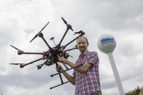
Greg Silsbe is a biological oceanographer and research assistant professor at Horn Point Laboratory. He is an expert in remote sensing, phytoplankton physiology, and African great lakes ecology. Recently, he has been using drones to help better understand water quality in Chesapeake Bay.
“NASA and the European Space Agency have earth-observing satellites that are continuously scanning and measuring the atmosphere and the surface of the entire earth. This data is freely available, and my interests are using it to better understand and track changes in water quality.
"The clearest natural waters are blue, while phytoplankton, which are microscopic photosynthetic organisms that are the base of aquatic food webs, are green. By examining satellite imagery, we can quantify the ‘greenness’ of the water and get a pretty accurate sense of the concentration of phytoplankton. Next, by analyzing the billions of snapshots taken across the global ocean each year, we can get a pretty good sense of how much carbon dioxide phytoplankton are converting into biomass, which helps us better understand the global carbon cycle and the food available for important fisheries.
“This type of analysis works really well in the open ocean, but in places like Chesapeake Bay, there are a lot of suspended sediment and dissolved organic matter that turn water color increasingly brown and make it a lot more challenging to translate a satellite image into accurate estimates of what is exactly in the water. As part of my research program, I’m going out into the Bay and measuring the concentrations of all these things in parallel with specialized cameras that mimic what satellites see. Once the data is analyzed, I start testing numerical algorithms to come up with an accurate way to translate satellite imagery into accurate maps of suspended sediments and phytoplankton. This way, every time a satellite passes over the Bay, we have a high-resolution spatial map of water quality, and because satellite data is free, it’s a very cost-effective way to monitor water quality.
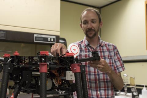
“Even the best satellites can only measure about 50 square meters resolution and you can only get satellite data when there aren’t any clouds. We can mimic the same sort of measurements that satellites are taking by attaching a similar type of camera to a drone. The advantages of a drone are we don’t have to worry about clouds or when the satellite will be passing, and we can acquire much finer resolution data.
“One of the things people are curious about with the oyster restoration projects in the Bay is whether these oyster reefs are improving water quality. What we can do is fly the drone over these oyster reefs and see if there’s a measureable difference in water quality above a reef versus off a reef. It’s a tool to map water quality in very, very high resolution that’s also really quick and easy to do.
“I have two types of drones. One is what we would call a regular camera, and from that you can get a sense of water quality. On the larger drone, I have what’s more akin to what’s being measured on the satellite. It’s not pictures or video, per se, but every second it’s measuring light spectra. For us, our human vision, we see red, green and blue combined, whereas this camera sees about 250 colors within that visible spectrum. With all that extra color data, it becomes easier to predict how much phytoplankton and suspended sediment is in the water.
“When we’re going out on a boat, we’re sampling one small parcel of water. Chesapeake Bay and estuarine environments, in general, are really complex. Having this technology really helps us augment the quantity of data and in turn, that will help us understand the Bay.”


