Chesapeake Bay Health Report Card Shows Broad Improvements in 2009
Ecological conditions in the Chesapeake Bay in 2009 received a “C” from UMCES researchers in their annual Chesapeake Bay Health Report Card.
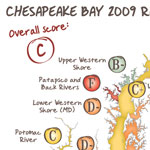
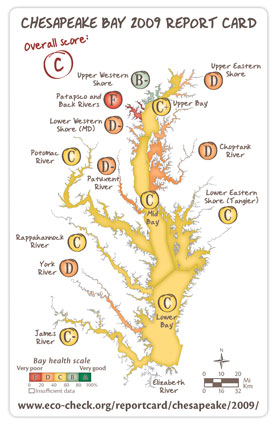
Ecological conditions in the Chesapeake Bay in 2009 received a “C” from UMCES researchers in their annual Chesapeake Bay Health Report Card (opens in a new tab). Noting improved conditions in eight Bay regions and degraded conditions in two, researchers from the UMCES Integration and Application Network note that the 2009 grade is an improvement over 2008’s “C-minus” and the highest mark since 2002.
Despite the improvements, the scientists added that additional restoration efforts are needed to return the Bay and its rivers to better ecological health.
While the Bay’s overall health earned a “C”, grades for 14 reporting regions varied, ranging from “B-minus” (moderate-good) to “F” (very poor). The highest ranked region, for the third year in a row, was the Upper Western Shore, which includes the Bush and Gunpowder Rivers. The lowest ranked region was the Patapsco and Back Rivers.
Despite those regional variations, scientists attribute overall improvements to last year’s unique regional rainfall patterns, continued efforts to reduce nutrient pollution within the Chesapeake Bay watershed and the gradual rebound in Bay health since the historically poor conditions observed in 2003.
“Despite the record high rainfall in parts of Maryland and Virginia, the mainstem of the Chesapeake Bay improved last year,” says UMCES project leader Dr. William Dennison. “Normally, more precipitation means poorer Bay health. But last year, the Bay benefited from below average rainfall throughout Pennsylvania which appears to have reduced the amount of pollutants reaching the open waters of the mainstem Bay.”
The report card analysis is conducted through the EcoCheck partnership (opens in a new tab) between UMCES and the NOAA Chesapeake Bay Office (opens in a new tab). EcoCheck analysts noted annual improvements in the Mid-Bay and Lower Bay mainstem regions, and in the Lower Eastern Shore, Lower Western Shore (MD), Upper Eastern Shore, Choptank, York and Rappahannock River regions. Scores decreased in the Upper Western Shore and James River regions.
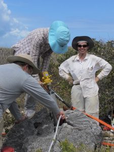
In addition, UMCES is working with local watershed organizations to develop river-specific report cards to give residents a creek-by-creek look at their local waters. These reports, funded by the Chesapeake Bay Trust, use data collected by trained citizen scientists to provide the organizations with a new set of tools to better explain local environmental health to their communities.
The report card, based on data collected by state and federal agencies through the Chesapeake Bay Program (opens in a new tab), provides an independent analysis of how the Bay is responding to annual weather variations and the pollution-reducing programs put in place by the Bay states and the federal government.